Cedar-Riverside 1: Bohemian Flats, Seven Corners, Cedar East, and Riverside Plaza
The Cedar-Riverside neighborhood may be Minneapolis’s most sharply delineated, occupying the approximately triangular region between Interstates 35W and 94 and the Mississippi River. However, the University of Minnesota’s West Bank Campus (except recent additions south of 4th Street) is officially part of a separate University neighborhood. Therefore, I skirted around this University area (with one small exception), leaving it for when I reach U in the alphabet.
To the south of the University, I chose 20th Avenue as the approximate dividing line between days 1 and 2 of my exploration. In the map below, the blue lines indicate the two paths I was able to walk just once (a main path and a separate northern loop in the Bohemian Flats area), while the red and purple lines are paths I needed to walk twice, both forward and back. (The red are spurs with immediate backtracking, whereas the purple is a connector along which I backtracked after finishing the Bohemian Flats area.) The connection at the southern tip of the Bohemian Flats loop lies within the University neighborhood; I shaded this technical departure from Cedar-Riverside in black.
Cedar-Riverside amply repays close attention. Every time I looked around, I spotted signs of the manifold layers of the neighborhood’s history and the lively diversity of its current use. Much of what I saw in these two days had escaped my notice in previous, more fleeting visits. And yet I know that in two days of walking and the corresponding two blog posts, I’m only scratching the surface. Take that as both an apology and encouragement.
Quite a few bus lines serve the neighborhood, as do both light rail lines. I chose to arrive by the number 2 bus, starting my walk at the corner of 3rd Street South and Cedar Avenue South. I took 3rd Street to 19th Avenue and turned north, following 19th Avenue along the boundary between the campus and the Seven Corners portion of the neighborhood, to which I would later return. Following 19th Avenue onto the 10th Avenue bridge (named for its other side) provided me with a good vantage point.


Returning to ground level, I walked past the Seven Corners Apartments, the Riverview Tower (a 1973 condominium monolith), and Riverbluff Cooperative, thereby gaining access to the parkland along the river: Bluff Street Park, the West River Parkway, and Bohemian Flats Park. As the interpretive signs make clear, these parks replaced the affordable housing of an earlier era.


As I turned back, I passed the entrance to the underground storage caverns of the Minnesota Library Access Center, a portion of the Elmer L. Andersen Library. This brought to mind how fortunate I had once been to participate in an unforgettable tour of these caverns.
Once back to 19th Avenue, I entered the area surrounding the intersection of Washington, Cedar, and 15th Avenues, which is known as the “Seven Corners.” I have repeatedly heard that this name derived from a prior street layout. However, I haven’t found an explanation of the specifics of that derivation. Therefore, I’ll make one up. My starting point is Grace Stevens’s 1915 map of “Social Factors in Seven Corners District.” (She was the socially-concerned librarian of the Seven Corners branch library, as described in Kirsten Delegard’s Historyapolis post.) The map covers a broader area, but I’ve excerpted the relevant portion below. The key seems to be to focus on the triangle I’ve marked with a red star, which is formed by Cedar and 15th Avenues and 3rd Street. Surrounding that triangle are seven blocks, as I’ve indicated with red numerals. I conjecture that this explains the name “Seven Corners.” (The S in the block I numbered 5 is Stevens’s indication of the Seven Corners branch library.)

The black rectangles that are the most common marker on the map indicate saloons. The area is still well endowed with these. Indeed, some of the same buildings are still standing and serving the same purpose. To take two examples, the ones in the blocks I marked 2 and 7 house Republic and Town Hall Brewery, respectively.


[Added after publication: The building holding Sgt. Preston’s and Republic was built in 1889, repaired after a 1911 fire, and then apparently had another significant fire in 1950, leading in 1950–1951 to its decapitation: it lost a fourth floor and the portion of the tower extending above the roofline, explaining its current appearance. An old photo shows all four stories, the fancy parapet above the fourth floor, and some of the tower.]
Likewise the northeastern corner of the block I marked 6 houses Bullwinkle Saloon. Initially I thought the saloon shown at the northern apex of the central triangle had similarly become The Corner Bar, but the city’s property records show that building as constructed in 1917, two years after Stevens’s map. Presumably it replaced an earlier building that had been serving the same function.
The blocks containing the Town Hall Brewery and Republic also each contain theaters, The Southern Theater and Theatre in the Round, respectively. The Southern Theater was also shown on Stevens’s map of “social factors” from 1915; the star she drew in the block I labeled 7 signified that it was then a movie house. (It dates from 1910.) Today it showcases live theater and dance.

Theatre in the Round has a fun exterior, painted as a mechanical drawing guiding its own remodeling with dimensions and instructions. For example, a note at the top describes how the existing sheet metal cornice was to be restored.


Down the little remnant of 15th Avenue and around the corner onto the even smaller dead-end remnant of 3rd Street, I found a somewhat hidden relic of 1968, which was on the leading edge ahead of most of the redevelopment in the Cedar-Riverside neighborhood.

Heading south on Cedar Avenue across Third Street, I came to one of the more overt reminders of the neighborhood’s strong history of cooperatives, including of the worker-owned variety, and of progressive politics. The building on the corner (301 Cedar Avenue South) contains both The Hub Bike Co-Op and Mayday Books.

On the other side of Cedar, a colorful mural serves as the initial view of the building housing The Red Sea, The West Bank Restaurant and Grill, and Keefer Court Café, three of the countless restaurants in the neighborhood.

With so many restaurants, my choice of a lunch stop was necessarily rather arbitrary. I had previously dined at several restaurants that primarily catered to visitors from outside the neighborhood, so this time I decided to try one of the Somali restaurants, which seem more oriented to the local residents. Even this category of restaurants was still large, so I simply chose the first one I encountered, which was the West Bank. I was the only Euro-American in the place, which I take to be a good sign.
I ordered a sambusa and a half order of goat with rice. (The alternative to rice would be pasta.) I also received a banana to eat with the rice, as Matt Pearce memorably described in the Los Angeles Times. My photo excludes the sambusa, which was on a separate plate, but I think I must have snapped the picture before eating it, judging by the amount of tasty green sauce left in the cup. The sambusa filling itself was also tasty. Indeed, even the rice was, benefiting from a spice mixture that included a lot of cardamom.

After lunch, I passed many more businesses and entertainment venues on Cedar Avenue, including The Cedar Cultural Center, a non-profit performing arts organization.

I then turned east from Cedar, circling through the Cedar East Commons, a residential area occupying most of the space between Riverside Avenue and Interstate 94 and between Cedar and 20th Avenues. Many of the homes are owned by the non-profit West Bank Development Corporation as part of the broader Riverside Homes and Blue Goose affordable housing projects. Some of these homes are organized as cooperatives. Other properties within the Commons are owner occupied. Management services are provided by Mutual Management Company, another non-profit. The Commons is a composite of two Planned Unit Developments: the Randy Stoecker Commons to the south of 6th Street and the Upper Summit to the north.
The photo below, taken from the intersection of 19th Avenue and 7th Street, looking north into the 600 block, shows the Cedar East Commons signage and some of the residences. In particular, the red building is the historic John A. Widstrom Tenement (1886), now owned by the WBCDC as the Sherlock Homes Cooperative.

Heading back westward across Cedar Avenue on 6th Street, I came face-to-face with the neighborhood’s most striking development, which had been in the background of many of my prior views. The Riverside Plaza complex reflects the sensibilities of the early 1970s both aesthetically and in its approach to providing affordable housing. Multiple blocks of run-down homes were simply demolished and replaced en masse with a high-rise complex inspired by Le Corbusier’s Ville Radieuse (Radiant City) concept and Unite d’ Habitation building.

Only seeing this complex makes the radical nature of Cedar East apparent, in which the existing mix of building ages, styles, and densities was cooperatively evolved through a combination of renovation and new construction. Randy Stoecker explains the historical connection between the two varieties of development on the two sides of Cedar Avenue in his book, Defending Community: The Struggle for Alternative Redevelopment in Cedar-Riverside.
From 6th Street, I turned south down the one-block segment of 16th Avenue that leads to the Cedar/Riverside Station on the Blue Line. On the west side of the avenue, a flat-roofed one-story building decorated with geometric mosaics is marked as the Daara-Salaam Grocery & Halal Meat market, while the adjoining building of plain blue-painted cinder blocks is marked as the Riverside Mall. (I was later to discover that the buildings are connected inside, so that the grocery is part of the mall.)


I was somewhat tempted to browse the grocery, but didn’t want to disrupt them, given that I had no intention to buy. The rest of the mall didn’t even give me any reason to want to go in — the only specific business I saw a sign for was a dry cleaner. However, as I was putting my camera-phone away and resuming my walk, a young Somali man came out of the mall and invited me in.
Jamal turned out to be a very enthusiastic tour guide. (Never mind that he had been on his way out. He put the rest of his day on hold for me.) He started by showing me the grocery store, pointing out the many bananas and explaining that they always accompanied pasta or rice. (I had gotten that right at lunch.) He also pointed out some of the favorite Somali ingredients from home, such as two different brands of sesame oil, one even named after a particular Somali city. (Despite having eaten Somali food a couple times now, I had no idea sesame oil was a key ingredient.)
Then he lead me through the rest of the mall. I had no clue how much was hidden inside that plain box. In addition to the dry cleaner, there was a restaurant, two money wiring services, immigration counseling, and a myriad of clothing and textile shops. Probably there were other shops too, but they failed to register in my memory as I was so stunned by the bright colors of the fabric. On the outside, the mall was just blue. On the inside, practically every available inch was covered with a brilliant range of colors as the different fabrics overlapped with each other, competing for visibility.
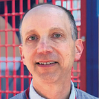
After making sure I had some sense of how the Somali-American community has made a home for itself in the neighborhood, Jamal once again exited the mall to go wherever it was he had been going when I arrived. He did me one more favor before leaving, posing for a photo.

One block further west on 6th Street, I turned initially south on 15th Avenue, which like 16th provides access to the light rail station. Unlike 16th, it crosses over the tracks and bends into a stub of 7th Street before dead-ending at a rail-yard gate. Rationally I might have ignored this little dead-end segment and headed immediately north on 15th instead, back toward the bustle of Seven Corners. However, one of the great things about walking every block is that I don’t miss the surprises that can arise on seemingly unpromising blocks.
In this instance, the corner of 15th Avenue South and 7th Street South is home to a former gas station from 1931, which presumably lost its business when freeway construction cut off through-traffic. But out of the gas stations’s death came new life in the form of Allen Christian’s House of Balls, an artist’s studio and gallery. Even my quick look around outside makes it clear that this would be worth a return pilgrimage, an impression amply reinforced by the web site.


When I did head north on 15th Avenue, I passed some new apartment buildings and the Brian Coyle Center before turning the corner onto 4th Street. At this corner an 1887 fire station houses yet another theater, Mixed Blood Theatre. (Cedar-Riverside is rich in theaters even without counting those that are on the University campus.)


One can’t exactly cross Cedar Avenue on 4th Street. There’s another, discontinuous portion of 4th Street to the east of Cedar Avenue, but if one walks straight across, one continues onto Riverside Avenue. Before crossing, though, I took another look at the building where I had lunched. The southern, Keefer Court side of the building has an even more dramatic mural than the one I had previously noted on the northern, Red Sea side. Indeed, in a neighborhood with many murals, this is a particular standout.

After walking a couple blocks of Riverside Avenue and looping back via 5th Street, I entered my home stretch, taking 19th Avenue back north to my ending point at 3rd Street. Recall that the University of Minnesota’s West Bank campus lies to the east of 19th Avenue. To the north of 4th Street, this counts as a separate neighborhood, starting with the main building of the Carlson School of Management, which is on the northeast corner of 19th Avenue and 4th Street. However, in 2008 the school grew across to the south side of the street, so that the new Hanson Hall counts as part of Cedar-Riverside. Thus, I was justified to pause in the accompanying sculpture garden for my last photograph of the day.